Yes, another round (or two) of severe weather and flooding is possible this week
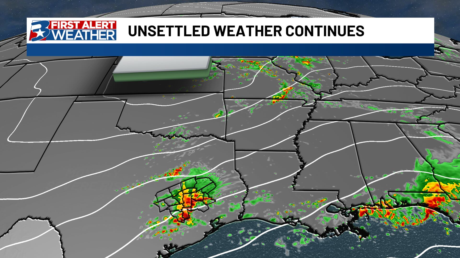
BRYAN, Texas (KBTX) – The already active late spring pattern continues right into the new work week. Two separate low pressure systems that will roll overhead Monday and into Thursday. Each system brings its own potential for severe weather (isolated), and the ongoing flooding potential, especially across the eastern half of the area, will continue.
Active pattern continues across the state of Texas, and the Brazos Valley is under the gun for at least two more significant chances for storms, some bringing heavy rain and the potential for severe weather.
The same low that brought us Sunday’s storms will likely be responsible for another round Monday, as early as mid-morning. With some inconsistent model data to work with, we currently think the biggest window for rain (and some strong storms) will be from about 10am-4pm Monday. Afterwards, skies look to clear pretty quickly into a nice Monday night leading into a very warm, but dry Tuesday.
Active pattern continues across the state of Texas, and the Brazos Valley is under the gun for at least two more significant chances for storms, some bringing heavy rain and the potential for severe weather.
The main risks are the same we’ve been monitoring for the past couple weeks now – some storms that will be capable of hail and strong wind will also likely be capable of dropping 1.5-2″ of rain per hour, so flooding immediately gets bumped to the top of our concerns.
How much?
Before the end of the week, an additional 2-4″ of rain is expected, with localized totals of 6″ or more not out of the question. While many communities along and west of Highway 6 are also plenty over-saturated, the greatest concern will be in the eastern half of the area, particularly Leon, Grimes, Walker, Madison, Trinity, and Houston counties.
Roads may once again become impassable, especially those that have already undergone damage due to previous flooding, or those over already swollen creeks and rivers.
Into the weekend
We may find yet another round of showers and storms this weekend, especially Saturday. While it’s a bit too specifics, another round of scattered showers and storms could roll in and try to wreck our weekend plans for at least a little bit of the upcoming weekend. There’s a chance this system passes us to the north or is weaker than currently expected, so we will keep fine tuning as we near the weekend.
All that to say, spring storms look to be far from over. Keep up to date with the First Alert team and the KBTX Weather app.


