Widespread tropical rains expected through Wednesday night
BRYAN, Texas (KBTX) – Before we arrive at midweek, we will likely have our first named tropical system of the 2024 Atlantic Hurricane Season.
We expect this system to make landfall south of the state of Texas, but it will be a mountain of moisture with it, likely causing some flooding in parts of the state.
Hurricane Hunters flew into this system earlier in the day Monday, and designated this disturbance as Potential Tropical Cyclone One shortly after.
The @NHC_Atlantic has initiated advisories on Potential Tropical Cyclone One (#PTC1) in the Gulf of Mexico. This means the system is not currently a tropical storm, but could become one and impact land areas soon.
Regardless of whether a tropical storm technically forms, inland… pic.twitter.com/DD0nn4ohLw
— Dr. Levi Cowan (@TropicalTidbits) June 17, 2024
PTC1 is expected to become the first depression and likely first named storm of the season as early as Monday night. While the center of circulation will likely stay to the south of the state of Texas (meaning, technically, a Mexico landfall) this system is bringing a wide-reaching swath of tropical moisture that will fuel widespread heavy rain across South Texas and the Texas Coast.
The likely first named storm of the 2024 Atlantic season will make landfall in Mexico. Why so much rain for Texas?
This storm is carrying a MOUNTAIN of moisture. Most widespread flooding should stay south of the Brazos Valley, but we’ll keep you posted. pic.twitter.com/yRatnkEvA5
— Max Crawford 👍 (@KBTXMax) June 17, 2024
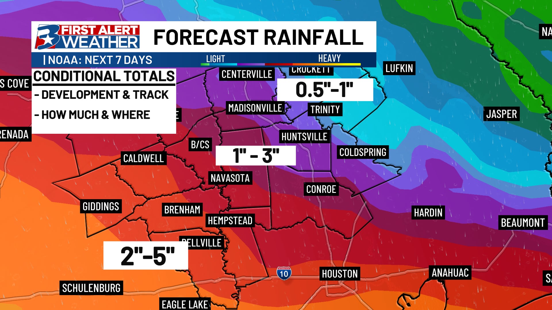
While the Brazos Valley should remain free of the more widespread flooding threat, we will be close enough to the storm and its moisture reach to get downpours capable of dropping an inch or more in less than an hour, especially on Wednesday but potentially into Thursday, too.
Widespread totals of 1-3″ across the central Brazos Valley, with 3-5″+ in some spots (especially southwest) will be monitored through Wednesday night. A Flood Watch is in effect for Austin, Waller, and Washington counties through that time. An isolated storm may be capable of pushing out some strong wind, too, especially Wednesday afternoon.
What could change – A track farther south will result in less rain for the area, while a track farther north could mean more rain. We will continue to fine tune the forecast, especially in times of rainfall totals, as we move throughout the week.