Wednesday is expected to be one of the hottest June 28th of record in Bryan-College Station
BRYAN, Texas (KBTX) – Another day, another HEAT ADVISORY for the Brazos Valley. The peak of this current heat wave is expected through the start of the weekend as a center of a heat dome — aka high pressure — passes over Central Texas and Louisiana. Wednesday’s forecast high is expected to become one of the — if not the actual — hottest June 28ths of record for Bryan-College Station.
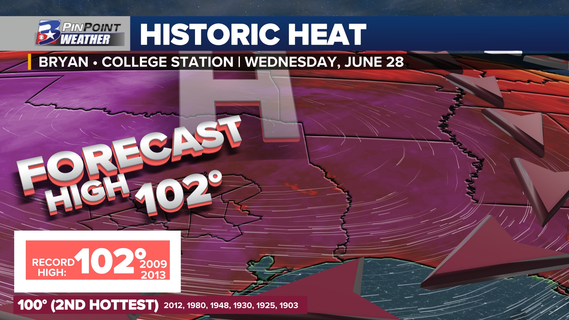
ALL-TIME HOTTEST OF RECORD
The current record high for June 28th stands at 102°, first touched in 2009 (14 years ago) and then tied in 2013 (10 years ago). The forecast for Wednesday at Easterwood Airport: 102° — and expected tie for the hottest 178th day of the year.
High pressure centered over North/Central Texas will push Brazos Valley highs to or near record levels Wednesday
What is climatologically interesting about this day: there has never been a high that landed at 101° at the official recording site for Bryan-College Station. The second hottest 28th of record currently stands at 100°. While anything but common, hitting the century mark on this day is not out of the ordinary. It first occurred in 1903, then tied in 1925, again five years later in 1930, then again in 1948, 1980, and 2012.
RECORD FOR SOME, BUT NOT FOR ALL
The Brazos Valley has four other official climate sites to gauge weather history from: Huntsville, Madisonville, Crockett, and Brenham. While these climate sites are not as long-standing as Bryan-College Station’s 141 years, their records for June 28th are significantly hotter. All other records at 105° and 106° are expected to remain in place for, at least, another year.
Other Brazos Valley climate sites hold records at or above 105° for June 28th
CLIMATE CHANGE’S FINGERPRINT
While hot temperatures are not unusual for the State of Texas and the Brazos Valley, this extreme of heat, high of heat index, and the longevity we have experienced it this early in the season are.
Bryan-College Station’s Climate Shift Index for Wednesday indicates Climate Change’s influence on the current heat wave
New data known as the Climate Shift Index now helps to identify man-made climate change’s impacts on day-to-day temperatures. That data tells us that this current heatwave and Wednesday’s expected record high are now two times more common due to this dominant climate influence.