Watching the Gulf: What to know about next week’s potential tropical rains
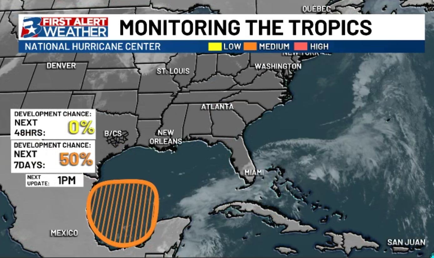
BRYAN, Texas (KBTX) – A wide, but at the moment “weak” low pressure system to looks to develop over the southern Gulf of Mexico by the end of this weekend into early next week. This system looks to move slowly northward from southern Mexico toward the states, giving the Brazos Valley our first chance of the season for some tropical downpours.
Scattered to widespread tropical downpours are possible as early as Monday across the area, where some areas could tally upwards of 3″ closer to the coast.
What we know
Widespread areas of enhanced moisture will roll into our area and Louisiana next week, charging up our typical, daytime summer showers and storms and giving them some added potential for isolated flooding. While we expect higher widespread totals (up to 6″+ in some spots along the TX/LA coasts) farther inland in the Brazos Valley will likely see less.
What we’re monitoring
The track of this system is not known yet, but impacts to the Texas Coast and parts of the Brazos Valley look likely at this point. There has been a little eastward shift toward Louisiana with some morning model data Saturday, but that is the exception to the rule so far. We will keep track of the wobbles and swerves over the rest of the weekend. Unorganized lows like these can be hard to nail down exactly where the highest rain falls, but the good news is we currently expect this system to remain relatively unorganized as it moves toward Texas/Louisiana.
Current forecast
Unless we see a continued dramatic shift east more toward far east Texas or even Louisiana, the expectation is around 1-3″ widespread across the Central Brazos Valley, with higher totals likely toward the coast. We could find an isolated strong storm or two with high wind, but the main impacts and overall concerns would be for some isolated flooding over the course of the week.
Scattered to widespread tropical downpours are possible as early as Monday across the area, where some areas could tally upwards of 3″ closer to the coast.
This pattern of wide open gulf moisture may persist a little into the weekend, with daily, isolated to scattered downpours expected through at least Friday. We will keep you updated as we learn more and fine tune the forecast.
Right now, the most widespread activity looks to arrive by midweek. Downpours could drop a quick one or two inches, leading to a minor, localized flooding concern.