Tropical Depression Thirteen forms in the central Atlantic
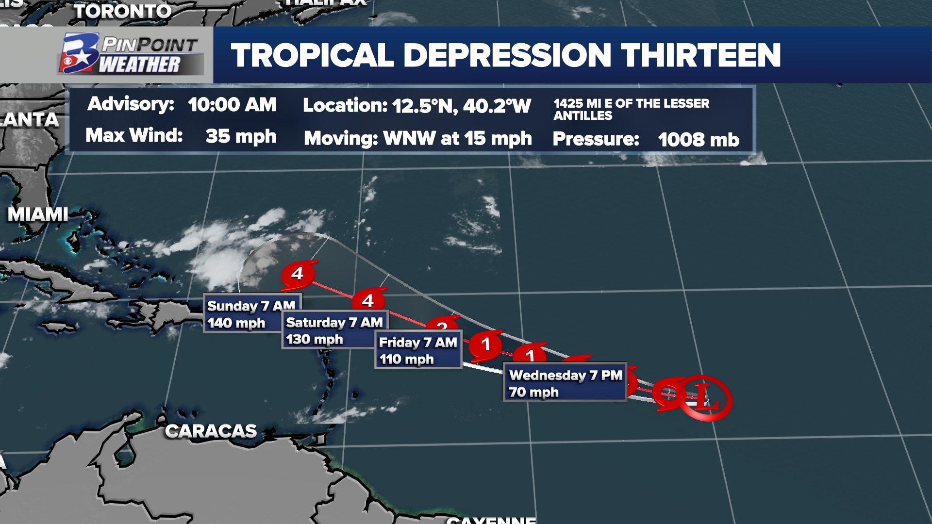
BRYAN, Texas (KBTX) – What will likely become Tropical Storm Lee is still very much in open water, about half way between Africa and the Lesser Antilles. As it continues to drift to the westward, continued organization is expected as it continues to move through a favorable environment for strengthening.
Future Lee will ride up a large high pressure system to its north, then potentially interact with the jetstream as it approaches the East Coast. This is where the storm may curve back to the east, away from the US coastline, but there is still considerable uncertainty leading into early next week.
Thirteen will likely strengthen to Lee as early as Tuesday, and is currently forecast to become a major hurricane by this weekend.
Some models have consistently been turning this system away from at least the southern portion of the East Coast early next week. We will get a better handle on its potential track later this week, but no issues are expected with this system for the Lower 48 through this weekend, as it will still be hundreds of miles east of the coast through Sunday.
The first NHC intensity forecast for Tropical Depression #Thirteen (#TD13) is insane #Lee high
This is the first time we’ve ever seen the NHC forecast a category 4 hurricane for a tropical depression in the Atlantic. https://t.co/vSm3IssDER
— Eric Webb (@webberweather) September 5, 2023