Soggy week ahead for the last full week of July
BRYAN, Texas (KBTX) – Most of the weekend was rain-free, but Sunday afternoon’s showers and storms are just the tip of a soggy iceberg for the week ahead.
A western ridge that has been set up for much of the past couple weeks looks to stay put, with additional ridging along the East Coast. In between, a trough of low pressure looks to get “stuck” throughout much of the week right over Texas, bringing multiple rounds of drenching showers and storms. Add in rich gulf moisture from the lower levels, and you have just about all you need for a cloudy, cool(er), humid, and RAINY week ahead.
Timing & Impacts
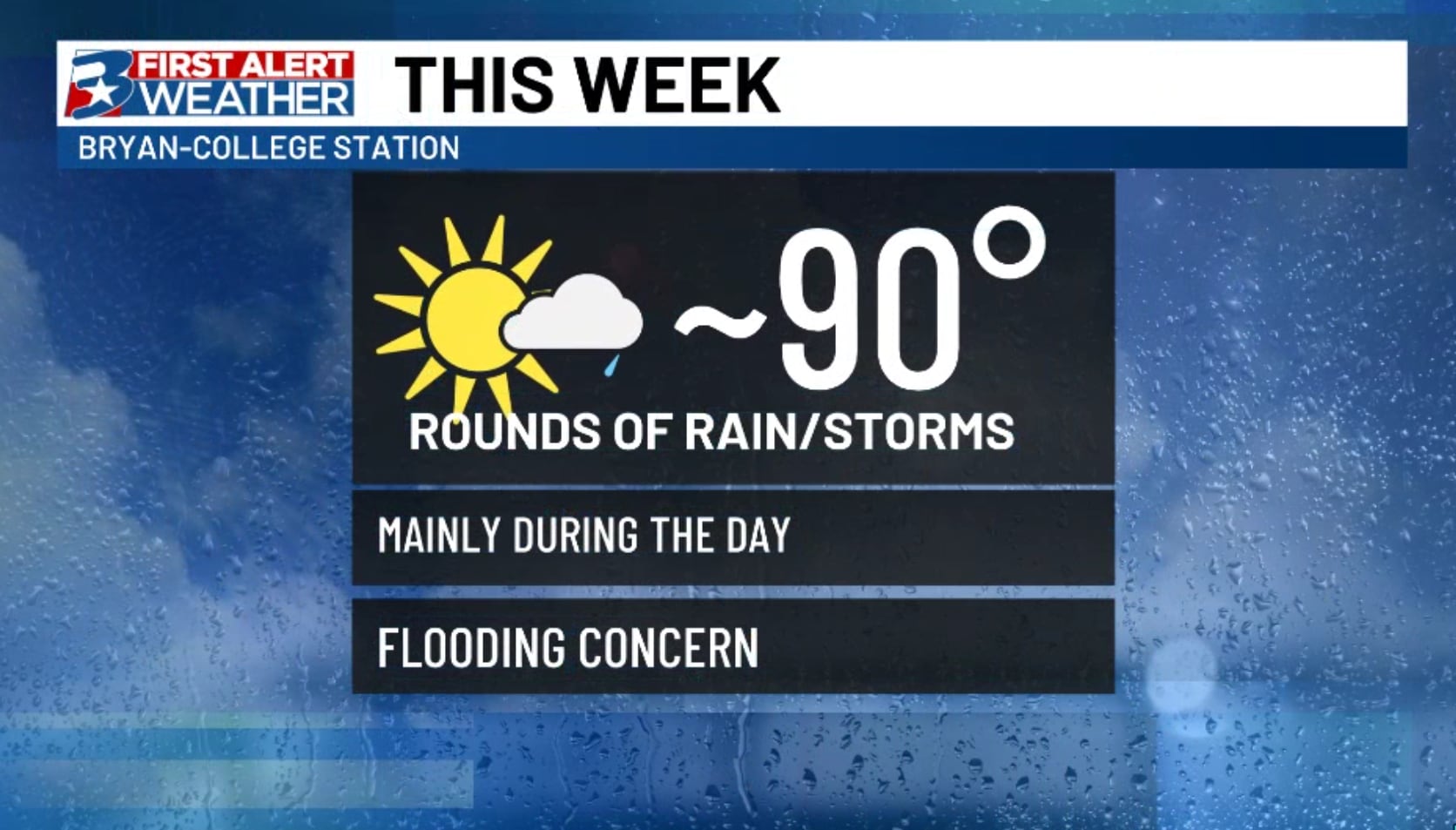
Widespread rain and storms will be possible every day through the end of the work week. We may see a drying trend start by this weekend.
With a setup like this in place, we typically see mostly daytime activity, but with passing disturbances at all hours of the day, we may see some non-severe overnight activity. Right now, it looks like the best chances for rain for most days this week will be from about 10am-6pm, with breaks in the activity especially toward the end of the week. Storms will be capable of dropping a quick 2-3″ in the strongest downpours, leading to an at least minor flooding potential at the onset of the first round of rain.
We’ll be stuck in between two ridges that will hurl little disturbances our way pretty much all week.
Add in continuous, unorganized globs of moisture, and we’re ripe for rain. Who gets the most depends on where the training bands set up, but plenty otw. pic.twitter.com/dSaUh7NMp4
— Max Crawford 👍 (@KBTXMax) July 21, 2024
Ironing out the finer details as we speak, but Wednesday and Thursday may bring us some of the more rigorous, most widespread rounds of storms. By this point, we expect at least a good portion of the area to be saturated, so areas of minor to moderate flooding will be likely before we find some drier days.
Speaking of, at the moment, we look to START to trim down coverage of rain by the time we get to the weekend, but confidence wavers in that department whether we will see high pressure take back over early enough to salvage outdoor weekend plans. In the meantime, keep the rain gear handy and stay locked in to your First Alert Weather App to find dry spots throughout the week!
Widespread rain and storms will be possible every day through the end of the work week. We may see a drying trend start by this weekend.
As an added bonus: If rain falls at the right time each day, there is a non-zero chance we stay at or below 90 degrees through the entire work week!