Next tropical depression likely to form Tuesday in the Open Atlantic
BRYAN, Texas (KBTX) – Two areas in the Atlantic have been marked for high likelihood of organization into at least a tropical depression over the next five to seven days.
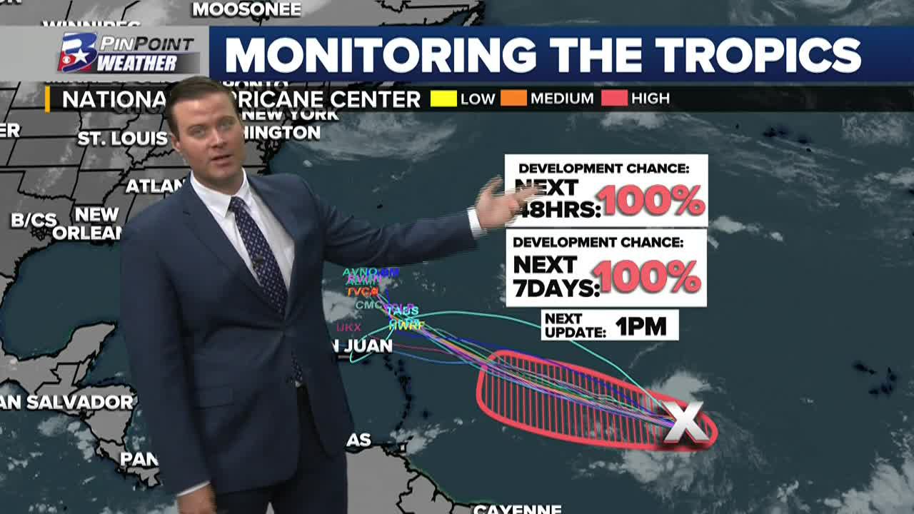
What will likely become Tropical Storm Lee is still very much in open water, about half way between Africa and the Lesser Antilles. As it continues to drift to the westward, continued organization is expected as it continues to move through a favorable environment for strengthening.
Future Lee will ride up a large high pressure system to its north, then potentially interact with the jetstream as it approaches the East Coast. This is where the storm may curve back to the east, away from the US coastline, but there is still considerable uncertainty leading into early next week.
What will likely become Tropical Storm Lee will keep drifting WNW as it strengthens. May curve away from east coast, but needs watching.
Aggies traveling to Miami: Regardless of development/track, this’ll be well east of Florida through the upcoming weekend, so no travel worries pic.twitter.com/OvNjW3wUqV
— Max Crawford 👍 (@KBTXMax) September 5, 2023
Some models have consistently been turning this system away from at least the southern portion of the East Coast early next week. We will get a better handle on its potential track later this week, but no issues are expected with this system for the Lower 48 through this weekend, as it will still be hundreds of miles east of the coast through Sunday.