Next tropical depression could come by middle of next week
BRYAN, Texas (KBTX) – After a decent break from tropical activity in the Atlantic Basin, we may have our next organized system before the end of the coming work week.
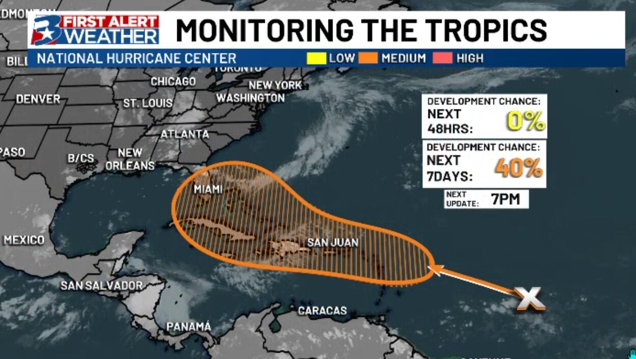
The National Hurricane Center has increased development odds on an area of “disturbed weather” (thunderstorms) that could be swept up by a nearby tropical wave later this week, where gradual organization is expected through the week as it moves into a favorable environment for development.
A cluster of thunderstorms may interact with a tropical wave by or before next week, and is worth watching for the Eastern US
As discussed many times before, tropical waters are plenty warm and ready to fuel new low pressure systems. This particular wave is still battling some Saharan dust, while the area of “disturbed weather” is one of the wetter parts of the Atlantic right now.
This tropical wave over the east-central Atlantic is truly gigantic.
These kind of very large, dry, & robust-looking tropical waves rarely go away quietly, often developing into TCs close to landmasses over the western portion of the Atlantic. pic.twitter.com/gKX9aAXfYa
— Eric Webb (@webberweather) July 28, 2024
This is a pretty complicated forecast for a couple different reasons, but there has been a good deal of agreement among models that some sort of tropical activity (whether just a batch of thunderstorms or otherwise) will likely impact eastern Gulf states or the East Coast by or around early next week. Some consistency is valuable, but between the actual wave being detached from the disturbance and a lack of organization, the “area to watch” shaded in orange above spans over a thousand miles from Florida to beyond the Lesser Antilles.
In other words, this is a long play, and one where it will likely be almost a week before any sort of certainty emerges. At the moment, however, this does NOT look to be a concern for the state of Texas.