National Weather Service unveils HeatRisk product as a new tool for heat awareness
BRYAN, Texas (KBTX) – You will soon see a new set of graphics on air and on your First Alert Weather app discussing heat and all the ways to describe exactly HOW hot it is and what risks it poses to your health. The national weather service has unveiled a new tool for heat awareness.
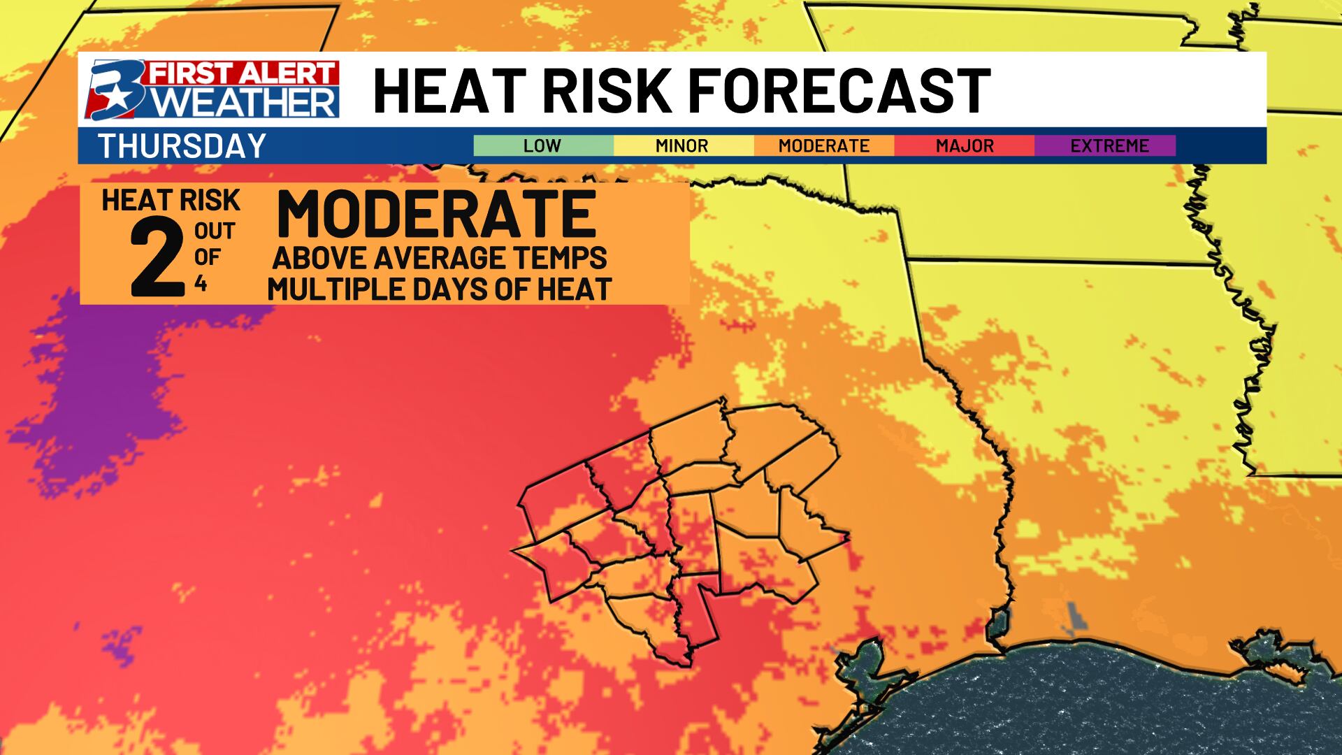
“HeatRisk” goes beyond just high and low temperatures. It takes into account a specific area’s geography, duration of a heat event, and even CDC data to illustrate the risk for heat stroke in an interactive, color coded map.
We’re excited to announce the newly-expanded NWS HeatRisk! HeatRisk can help people understand what heat will mean for them, their families, and their community. Visit the interactive HeatRisk viewer: https://t.co/ApZMSCVwta
You can provide feedback at https://t.co/mo4XNgDs0M pic.twitter.com/T5EjvmoFLf
— National Weather Service (@NWS) April 22, 2024
Tim Cady is a meteorologist at the National Weather Service Houston/Galveston office. He says, at the very least, he hopes this product helps bring awareness to a specific day’s heat and the risks it poses to prolonged exposure.
“Something I always ask people is, what is the #1 weather-related killer every year? And nobody has ever said heat,” says Cady. “And [unfortunately] that’s the case, it’s the number 1 killer every year, most of the time.”
Cady says this collaboration between the CDC and NWS meteorologists is a long time coming, and the ultimate goal is to prevent heat related illnesses.
“Although it may not stand out in a headline like floods or a tornado does, it certainly contributes to thousands of hospitalizations and hundreds of deaths across the country every year.”
You can always find HeatRisk maps for the Brazos Valley or any part of the US here. On days where we deem the risk for heat illnesses particularly high, you will see these products from the First Alert Weather team, too.