National Weather Service implements a more consistent Brazos Valley snow, ice advisory criteria ahead of winter
BRYAN, Texas (KBTX) – The Houston/Galveston National Weather Service (NWS) office announced new snow and ice criteria for winter storm watches and warnings in the Brazos Valley Tuesday. The agency is also adding the possibility of an Ice Storm Warning in the event a winter weather system could greatly impact local infrastructure.
The 16 Brazos Valley counties fall under the jurisdiction of three different National Weather Service offices, with the majority of our local counties serviced by the Houston/Galveston branch. Here is how the area breaks down:
Houston/Galveston NWS: Austin, Brazos, Burleson, Grimes, Houston, Madison, Montgomery, San Jacinto, Trinity, Walker, Waller, Washington Counties Fort Worth/Dallas NWS: Milam, Robertson, Leon CountiesAustin/San Antonio NWS: Lee County
WINTER STORM WARNINGS
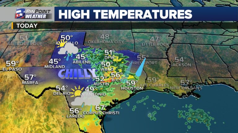
For all but Austin, Waller, Mongtomery, and San Jacinto Counties, the new snow criteria for a Winter Storm Warning to be issued is a forecasted snowfall of two (2) inches or more. These warnings will now be issued for snowfall that is expected for the entire winter weather event rather than the old standard which was based on 12-hour and 24-hour snowfall predictions.
For the remaining local counties, along with the Houston Metro and far Southeast Texas, the criteria for a warning to be issued is one (1) inch or greater during an anticipated event.
Dan Reilly, the Warning Coordination Meteorologist with the Houston/Galveston NWS office, wrote “The Winter Storm Watch/Warning criteria are meant as guidelines, but remember in certain cases even lesser amounts of snow can create very dangerous conditions. In such a case, NWS might issue a warning based on the expected impacts.” For example, in a flash freeze scenario, lesser snowfall amounts may warrant a warning due to higher expected impacts and potential disruptions.
The agency added that there will be no change to the Winter Weather Advisory snowfall criteria.
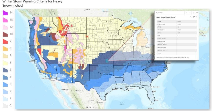
A map of the criteria across the entire Contiguous United States can be found here.
ICE STORM WARNINGS
Effective immediately, the National Weather Service now has criteria for the issuance of an Ice Storm Warning in the event a 1/4 inch of ice accretion, due to freezing rain, or more is expected. This will be the case for the all 16 counties locally, along with all of Central and Southeast Texas. Reilly says these warnings “will be used for cases when impacts to infrastructure are possible. The combination of ice accretion and wind can lead to power outages.”
Winter Storm Warnings would also still cover any ice accretion of 1/8 inch or less. Ice accumulation from sleet alone would fall under a Winter Storm Warning or Winter Weather Advisory since it only impacts road conditions and not electricity infrastructure.
Reilly added a reminder that if the Brazos Valley does experience a winter storm where power is lost “to be especially careful if you are using a generator. Make sure it is operated in a well-ventilated area outdoors. Now is a good time to review these procedures.”
Of course, the PinPoint Weather Team will pass along any winter weather advisories, watches, or warnings as they are issued by the National Weather Service on-air, online, on social media, and through the PinPoint Weather App.