Multiple hazards to monitor heading into Thursday
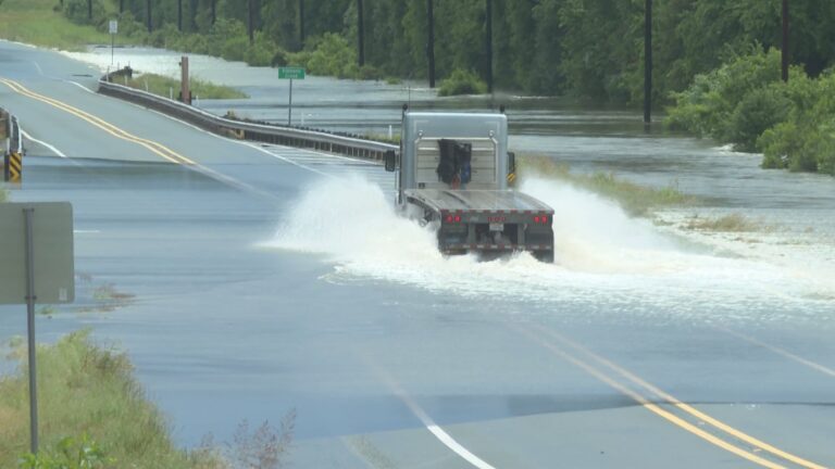
BRYAN, Texas (KBTX) – Sunday night’s storms left the Brazos Valley ground extremely saturated, especially areas east of Highway 6. In anticipation of yet another round of widespread rain that could be heavy at times, the National Weather Service has issued a Flood Watch.
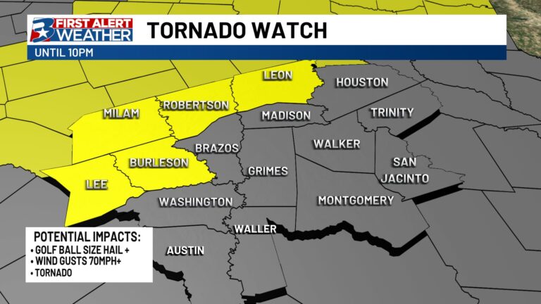
Wednesday evening update: With widespread thunderstorms already starting to fill into the area and intensify, A Severe Thunderstorm Watch has also been issued until 2am Thursday morning.
A WATCH means conditions are favorable for finding severe storms, including storms that produce damaging wind and hail in addition to very heavy rain.
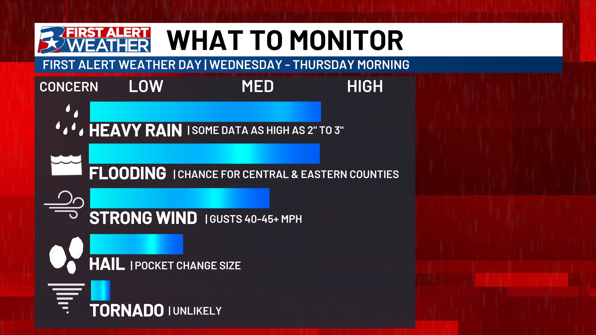
Though quarter sized hail and wind gusts 50mph+ are still possible with the strongest storms we see tonight into Thursday, the primary concern is still for flooding, which could make more than a few headaches for Thursday morning’s drive.
Latest data can be found on the KBTX Weather app, online, and on air as necessary through the overnight and right into Thursday.
FLOOD WATCH BRAZOS VALLEY: MAY 1-2
Wednesday evening data suggests the more widespread rain and thunderstorms are expected to develop out west and move into the Brazos Valley through the overnight hours. While severe weather will also be possible, some of the stronger storms will be capable of dropping multiple inches of rain in a short amount of time. This is especially a concern for those who saw storms this morning, especially across our northern counties.
Widespread rain and storms, some severe and producing heavy rainfall, are expected into the morning hours Thursday.
The main concern will be for hazardous driving conditions due to flooding. Some of the hardest hit areas of the Brazos Valley picked up nearly a foot of rainfall Sunday night through early Monday. It does not take much to reaggravate those flooded areas, and we look to receive more than enough to cause issues. Widespread totals with this evening sit between 2″-4″ with isolated areas potentially able to collect 5″-8″ under the strongest and heaviest storms. As storms dissipate through sunrise Thursday, additional time will be needed for waters to recede, hence the Watch lasting through Thursday evening.
The primary concern with each round will be flooding. However, all severe hazards are possible. Additional updates can be found wherever you get your information from the KBTX Weather team, including the app.