Mid to upper 90s return as high pressure takes back over Texas
BRYAN, Texas (KBTX) – All good things most come to an end! The week’s long spell of cooler and WETTER weather looks to turn back to a more typical hot and dry to finish July and go into the first couple days of August.
After a widespread 3-5″ fell across the entire Brazos Valley, there are some who may be looking for more rain, but many who could use a chance to dry things out, and that’s exactly what we’ll get through pretty much the entirety of the next week.
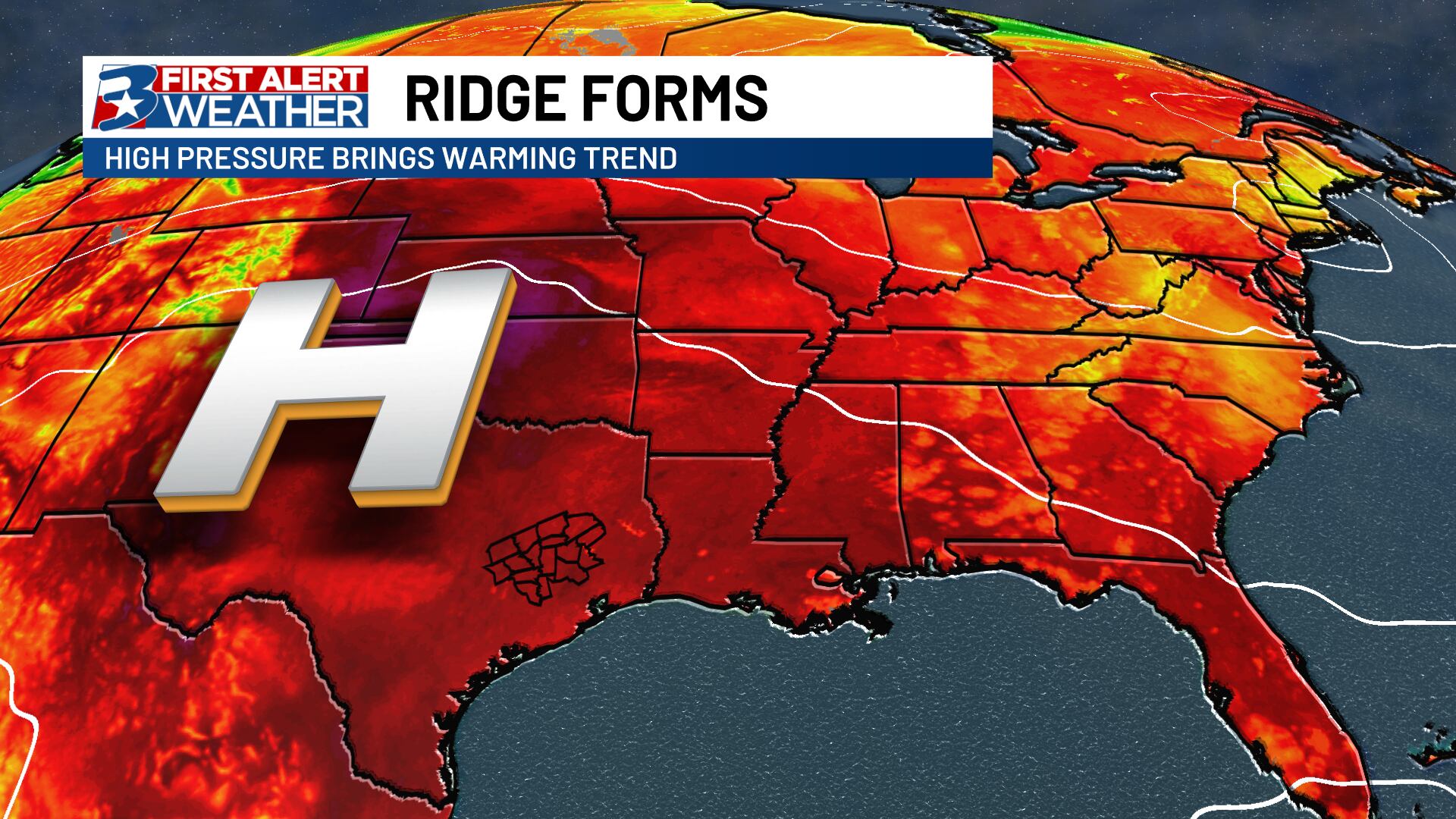
High pressure returns
High pressure slides into the Lonestar State and kicks off a series of hotter, summertime temperatures.
We were stuck in between two large ridges of high pressure last week. The western ridge looks to expand and move over the Great Plains and state of Texas throughout next week, “pushing” down on the atmosphere and bringing back a near cloudless afternoon sky after some morning fog and cloud cover. This will allow temperatures to soar back into the mid to even upper 90s for several days next week, with very little relief in the form of rain, save for maybe Monday and again late next weekend.
Avoiding the triple digits
At the moment, despite the strength of this ridge and widespread summer heat across the Lower 48, the wet weather we have seen over the past week should allow us to stay below the triple digit mark, largely thanks to evaporative cooling.
TWO things you will want for the next week: Sunscreen and DEET. Mosquitoes have loved this past week just as much as we have, so be sure to remove any standing water from around your home if possible to prevent additional breeding in your neighborhood.
High pressure backs off a bit as we settle into next weekend, which may allow for some seabreeze showers/storms to get sparked up in the afternoon once again, but there isn’t anything on the horizon that looks as widespread as what we saw last week, at least at the moment. Stay cool!