Hazy skies ahead! Biggest plume of Saharan dust this summer arrives by mid-week
BRYAN, Texas (KBTX) – Hazy skies filled the views of the Caribbean, Southern Gulf of Mexico, Jamacia, Cuba, and South Florida over the weekend. By mid-week, the Brazos Valley’s blue summer sky will be traded out for a gray, dull, milky look as the highest concentration of Saharan Dust sweeps in from the Gulf of Mexico. Dust that has traveled more than 5,000 miles across the Atlantic to reach our sky!
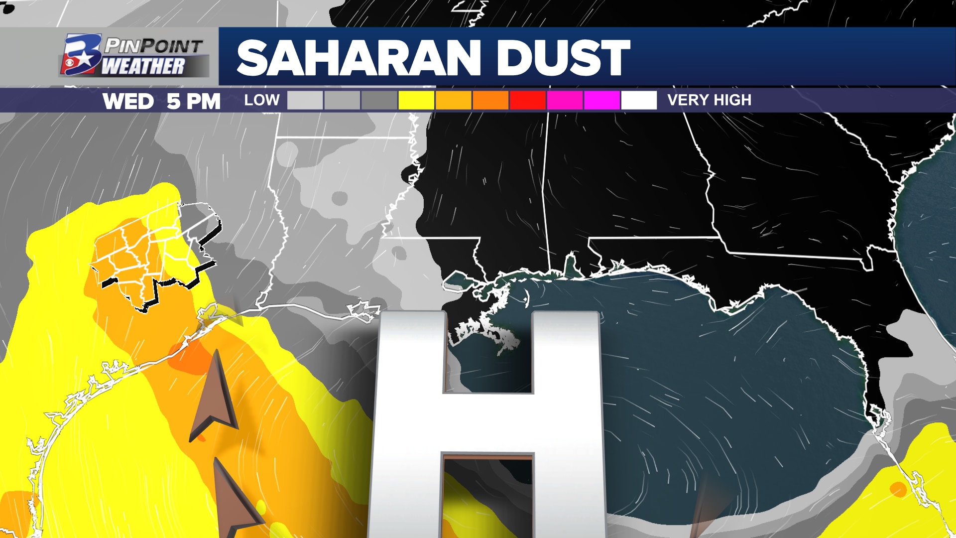
While there have been traces of this dust in our air almost consistently over the last month, the final full week of July will bring the biggest batch of the summer phenomena the Brazos Valley has experienced this year Clockwise flow around an area of high pressure over the eastern Gulf of Mexico will steer these hazy views starting Tuesday, peaking Wednesday, and then slowly scattering out of the atmosphere through the end of the week and weekend.
Hazy skies are expected to peak mid-week over the Brazos Valley
While a light haze is expected to linger through the final days of July, the air quality and blue tint of the sky should improve by Saturday. This haze could make for some interesting sunrises & sunsets, those with sensitive respiratory conditions will need to monitor air quality conditions over the next few days as the dust filters through.
The National Hurricane Center has been monitoring a tropical wave, labeled Invest 95L, as it moves west through the Tropical Atlantic toward the Eastern Caribbean. The dry air associated with this plume of Saharan Dust, along with increasing upper-level winds, is currently expected to keep tropical development at a minimum or at bay as this area if interest reached the Lesser Antilles. As of Sunday evening, there were no tropical concerns for the United States coastline.