Grimes County Road & Bridge Department responds to flooded areas
GRIMES COUNTY, Texas (KBTX) – Since Monday, Grimes County has received about 4 inches of rain which has caused flooding in a few places.
In Grimes County, the Road and Bridge Department has been busy keeping up with flooding.
Jonathan Steiber, the Grimes County Engineer for the Road and Bridge Department, says that the heavy rainfall brought flooding to some areas.
“You can get rainfall in certain areas that are more intense than just a few miles away. So you may have a spot on a county road that floods under some circumstances and spots on a county road that floods under other circumstances,” said Steiber.
According to the department, they have two maintenance areas that are split by Highway 30, North and South.
Each area has a superintendent and crews that know exactly what areas flood often.
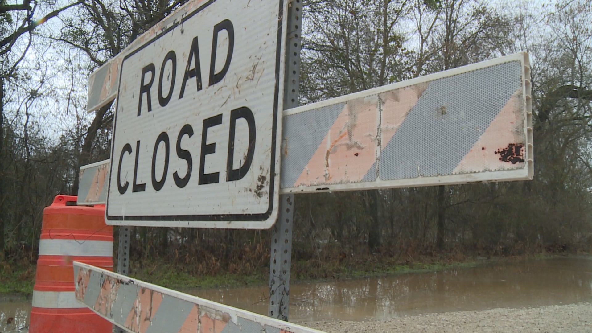
The Roads and Bridge Department of Grimes County responds when roads get dangerous and floods occur.
“We put out barriers, we put out cones, we’ll park vehicles so that traffic can see lights if we need to or if we ever run out of equipment or the crossing is too much where there’s high water. We do that whenever we get rain like this,” said Steiber. “We don’t want people driving in high water, so the barricades, cones, parking, and blocking those areas off. A lot of them [roads] don’t stay flooded that long, but you want to block those areas from traffic while there’s water crossing the road.”
Tuesday, several roads were blocked for flooding including Co Rd 232.
“We pretty much just block it off, we don’t have enough resources to fix it at the moment. We have to wait until the water drains off and then we do everything we can to make sure it doesn’t happen again,” said Payton Acord, a Grimes County mechanic for the Road and Bridge Department.
The Road & Bridge Department of Grimes County has taken many measures to keep the public safe including picking up any trees or branches that may have fallen into the road, communicating with the public about road conditions, and providing alternate routes for people to take.
“We make sure everybody is informed that the road is not able to be driven on. And if possible, find alternate routes for people to take so they can get home safe,” said Acord.
The department also keeps an eye on rain gauges like this to monitor water levels.
They look at rain gauges to “see how much it has rained. The ground reaches a certain level of saturation where you have more runoff the more rain that you get. So when you have more waves of rainfall like this, we try to keep track of how high the water is, how much more rain we’re getting, what could those water levels be, and kind of anticipate where those flooded areas will be,” said Steiber.