Defroster morning, windshield wiper afternoon: Quick storm system brings widespread rain Tuesday
BRYAN, Texas (KBTX) – An active jetstream is set to bring some much needed rain to Texas and the Brazos Valley over the next week. As model data rolls in this morning, it looks more and more like we will get into a pattern of widespread rain, a couple pleasant days, then repeat.
That starts today!
Doesn’t quite have the “look and feel” of a rainy day, but changes are quickly coming by the afternoon drive!
Today into tonight is one of several different shots at beneficial rain in the forecast: pic.twitter.com/4XVfC9mYAq
— Max Crawford 👍 (@KBTXMax) January 2, 2024
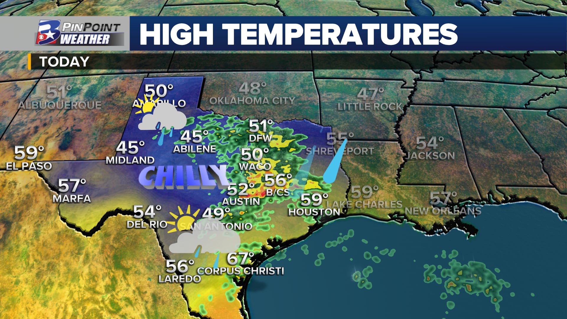
Tuesday’s low pressure system is already bringing rain to far West Texas and snow to portions of the southern Rockies. Before lunch time, widespread rain is set to fall west of the I-35 corridor, and the radar will “fill in” from west to east after that.
For the Brazos Valley, though it wouldn’t hurt to have the rain gear by lunch time, or main round of wet weather looks to roll in around the afternoon drive home. Widespread rain (at times heavy) and some rumbles are the primary impacts here. Large-scale instability is lacking, which means most will be talking some good old fashioned rain and the occasional gust in excess of 25mph.
As mentioned, we’ll string together a couple pleasant winter days Wednesday and Thursday before more rain returns to finish the first work week of 2024. While that may mean the beginning of our weekend brings another round of wet weather, we largely expect clearing by Friday afternoon/evening at the earliest, with another nice day or two Saturday and Sunday ahead of yet another system Monday.
Every 2-3 days will give another widespread chance at drought-denting rain across the Brazos Valley
It’s a good week to keep the app handy as we look ahead to some drought-denting rain. Cheers!