Beryl and the Brazos Valley: What to expect going into next week
BRYAN, Texas (KBTX) – Following a long journey across the Caribbean and a very short stay over the Yucatan Peninsula, Beryl has emerged back in the Gulf of Mexico and is poised to become a hurricane again, with a Texas landfall all but certain at this point.
As Beryl has emerged back in the gulf, we continue to monitor the track and intensity of the Storm, as this will have big consequences on our rainfall totals next week, especially Monday.
If you would like a little model/data chat, keep reading. For Brazos Valley specific impacts, you will want to scroll down a little toward the bottom of the article.
What changed?
Since moving over but not quite making landfall over Jamaica, Beryl has maintained more strength than previously expected. A couple things we were expecting (but not certain) Beryl would do, but didn’t:
-Make landfall over Jamaica
-Weaken after encountering unfavorable upper level winds
-Spend a significant amount of time over the Yucatan Peninsula on a mainly due west trajectory
Between the above scenarios not happening and a weather models bias that consistently placed Beryl’s center of circulation a bit farther south than it actually has been, forecasters at the NHC (and in the First Alert Weather Center) have had to make a significant change in the forecast track, which significantly changes potential impacts for portions of the Texas Coast and the Brazos Valley after that.
Through the rest of the weekend
This will be the amount of time Beryl will have to strengthen in the Gulf. A couple things working against the storm as of Saturday morning include reorganizing after Yucatan landfall and some dry air that has entrenched itself in the system. These two together may allow for only slow strengthening at first. However, with this storm expected to make its northward/eastward turn somewhat parallel to the Coastal Bend of Texas, that may allow for more time to organize over a bathtub hot Gulf of Mexico, and make for a very tricky landfall forecast.
Beryl is currently forecast to be at Category 1 strength and within the “cone of uncertainty” includes all of the Texas Coast. But as of Saturday morning, most likely landfall looks to be somewhere between Corpus Christi and the Matagorda Bay, or somewhere along the Middle Texas Coast.
Why this matters for the Brazos Valley
The farther east this storm trends, the more widely varying rain we will see from this storm. At current, the forecast cone spreads over the entire Brazos Valley, meaning the center of the Storm could pass anywhere between western Lee County and eastern Houston County before the end of the night Monday. The center line of this forecast track splits the Brazos Valley in half.
The forecast track is currently painted right over the Brazos Valley. At the moment, this means a LOT of rain for the entire area. A shift to the east or west could dramatically alter the rainfall forecast.
In other words, at this point, there is a scenario that plays out where many of us get all of the wind and none of the rain (being on the west side of the system) OR all of us collect several inches of rain before the week is over.
BRAZOS VALLEY: Where we go from here
As Beryl has emerged back in the gulf, we continue to monitor the track and intensity of the Storm, as this will have big consequences on our rainfall totals next week, especially Monday.
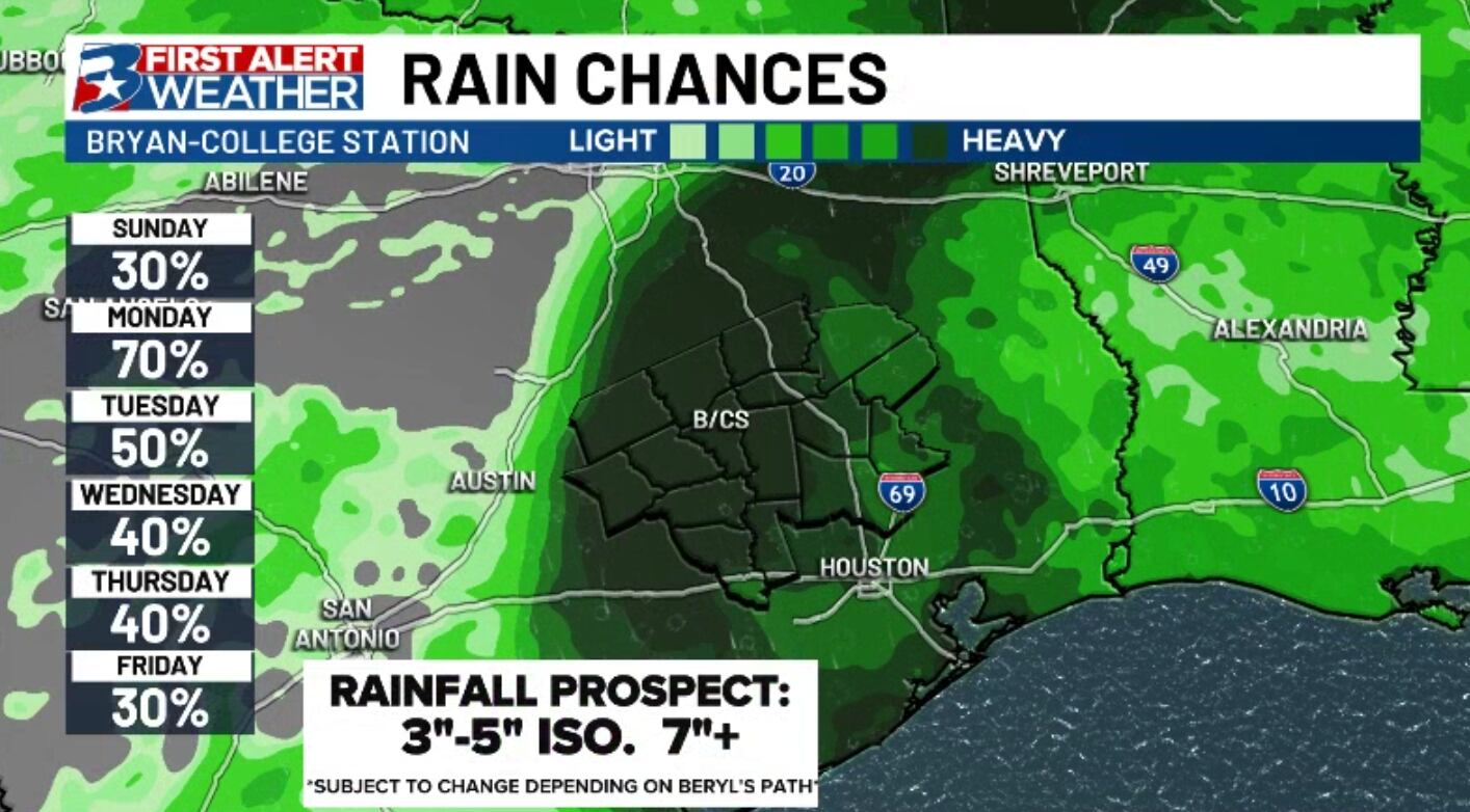
Saturday should be a big day for fine tuning of the forecast, and checking on our coastal friends to make sure all preps are underway and completed before the end of the weekend. While the forecast has been one of wet weather for much of next week, we still expect a large portion of the area (especially along and east of Highway 6) to receive a lot of rain, especially on Monday and potentially again on Tuesday.
First bands from Beryl may arrive as early as Sunday, though Saturday brings its own chances for showers/storms thanks to a weak front that moved into the area overnight. Wind will pick up as Beryl gets closer to the area, but we likely won’t feel “breezy” until Monday morning. Monday looks to be the windiest day, but exactly HOW windy we get is entirely dependent on Beryl’s strength at landfall. Within some isolated storms, some strong wind gusts will also be possible.
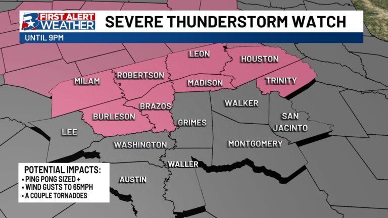
Heavy rain and some flooding will be the biggest concern as Beryl moves through the Brazos Valley, but some strong winds and a tornado or two will be possible, especially east of the storms main circulation.
As many will be to the east of the center of circulation of this storm, we cannot rule out a couple brief spin-up tornadoes. Typically, these are few and far between and relatively weak, but it is one of the things we will watch closely, especially Monday afternoon/night.
As Beryl has emerged back in the gulf, we continue to monitor the track and intensity of the Storm, as this will have big consequences on our rainfall totals next week, especially Monday.
While this rainfall forecast is subject to change depending on where exactly Beryl is positioned and how strong it is at landfall, widespread amounts of 3-5″ (mainly falling on Monday) with localized totals of 7″ or more still look possible. If the track continues to nudge itself EASTWARD, these numbers WILL come down.
A tricky forecast, but one we will continue monitoring nonetheless. Updates can of course be found here, on your First Alert Weather app, and on-air throughout the weekend and into next week.


