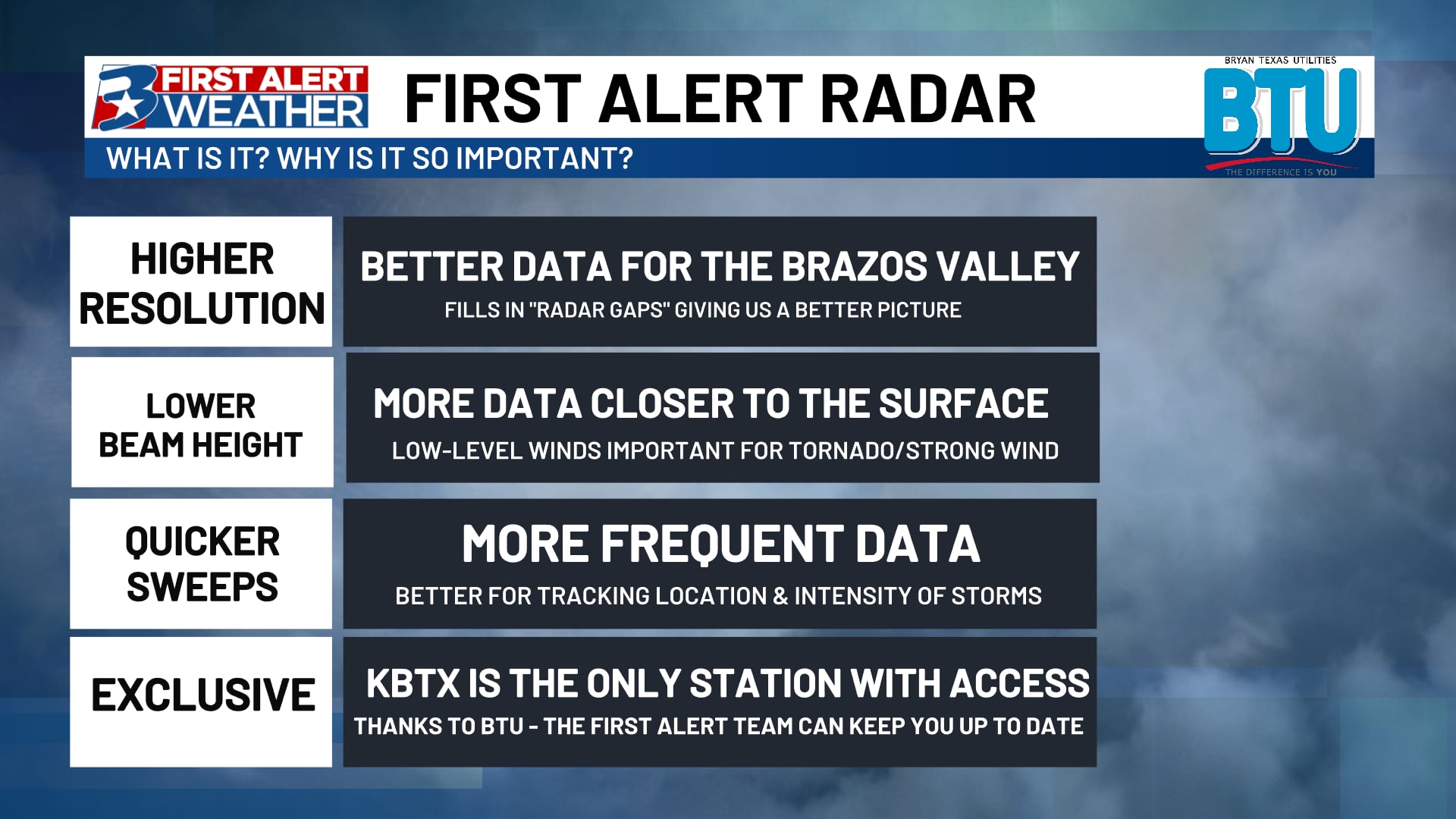
Beam height and the Brazos Valley
BRYAN, Texas (KBTX) – Sitting atop of the Eller Oceanography and Meteorology Building is the newest addition to the First Alert Weather Team, the First Alert Radar! There are many advantages to our new radar brought to us in partnership with Bryan Texas Utilities, Climavision, and Texas A&M University. One of those is lower beam height.
When we are scanning the atmosphere, we use multiple radars that are a part of the NEXRAD network, one of the main radars we rely on is out of Fort Cavazos. This is a perfectly fine radar, but the main issue is that it is 63 miles away from Bryan-College Station. This means that as the radar beam shoots overhead, it is looking over four thousand feet above ground level.
When shooting so high into the atmosphere it leaves a crucial gap closer to the surface. The First Alert Radar in comparison is only scanning 300 feet above ground level, helping us get a better picture of what is happening closer to home.
Filling in that blind spot is exactly what the First Alert Radar is made for. This will give us critical information when it comes to flash flooding events, low-level winds, tornadoes, and will even improve near-surface modeling with better near surface observations giving us more accurate forecasting data.