Astral event eclipsed by severe storm chance next week
BRYAN, Texas (KBTX) – We have been talking about it since the last one. You may have heard – an eclipse is coming to Texas next week! And it’s crossing over a highway that’s already a parking lot most days.
Aaaaaand it may be completely blocked out by clouds. Welcome to Texas spring, eclipse!
First thing’s first – we’ve got a neat little weekend ahead!
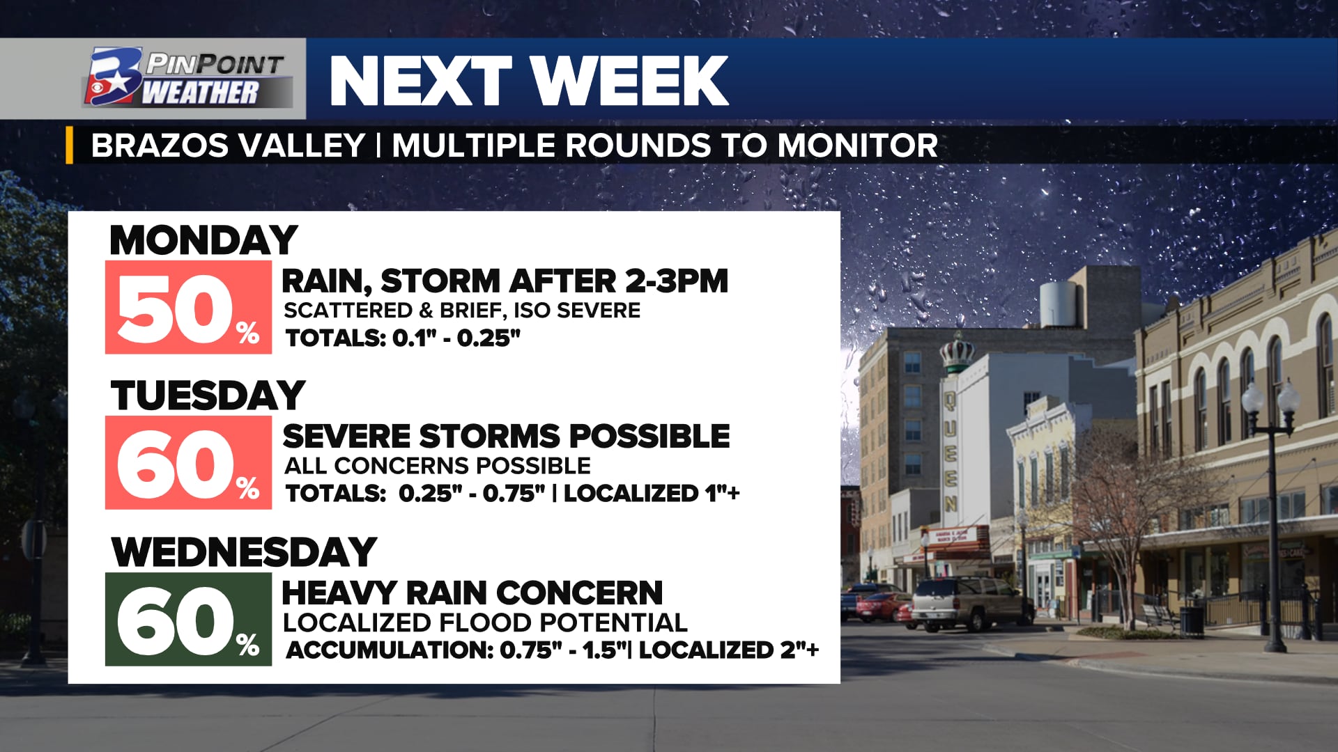
Widespread showers and a few thunderstorms are expected in the Brazos Valley as early as next Monday. A slow moving storm system will keep the rain/storm chance in play until a cold front pushes out all the moisture by Thursday.
Friday evening starts a little toasty, but we’ll keep a nice south breeze and temps in the 70s return quickly to get the weekend started on a lovely note. By Saturday morning, we’ll lose most of that “crisp” feeling the last few mornings have given us, but it’s still comfortable. The only real concern for Saturday is for some patchy fog, but that lifts quickly as the breeze picks back up and we head back for the 80s.
The much talked about “first” cold front tries to sneak into our area Saturday night. We don’t expect it to change temperatures at all, but that boundary COULD be enough to spark a few showers by early Sunday. Nothing heavy expected, but we can’t rule out a quick downpour at any given point Sunday. Still, you’ll probably be fine if you happen to forget the rain gear at home.
MONDAY’S SOLAR ECLIPSE:
We’re hoping for high clouds at best.
We’re expecting scattered low clouds to allow peeks of viewing.
We’re crossing our fingers those low clouds don’t take our view away completely.
☀️🤝🌑🤝☁️#bcstx pic.twitter.com/ZDjkBZ6PCM
— Shel Winkley 👍 (@KBTXShel) April 5, 2024
Eclipse Day – A warm front is still expected to advance northward across the state Monday. While that doesn’t fully guarantee overcast skies into the afternoon, it will at the very least make for a cloudy morning, and give us some fuel for afternoon downpours and a couple storms.
Widespread showers and a few thunderstorms are expected in the Brazos Valley as early as next Monday. A slow moving storm system will keep the rain/storm chance in play until a cold front pushes out all the moisture by Thursday.
If you’re staying local, we feel there is a pretty good chance of NOT getting rained on, at the very least. That said, the farther we go into the afternoon, the more likely we are to see some scattered storms on radar. Said storms, while not overly likely, may be capable of turning strong quickly. At the moment, we expect that risk to be higher later in the day and to our north and east, but storms capable of strong winds and hail won’t be ruled out for both Monday and Tuesday.
Rest of the week – The forecast gets hairy from here. While daytime showers and storms will be the most likely outcome until Wednesday’s front arrives, Monday and Tuesday’s rain and storm chance may largely depend on activity to our north. Lingering storms and/or boundaries could be the focal point for additional development through midweek.
Widespread showers and a few thunderstorms are expected in the Brazos Valley as early as next Monday. A slow moving storm system will keep the rain/storm chance in play until a cold front pushes out all the moisture by Thursday.
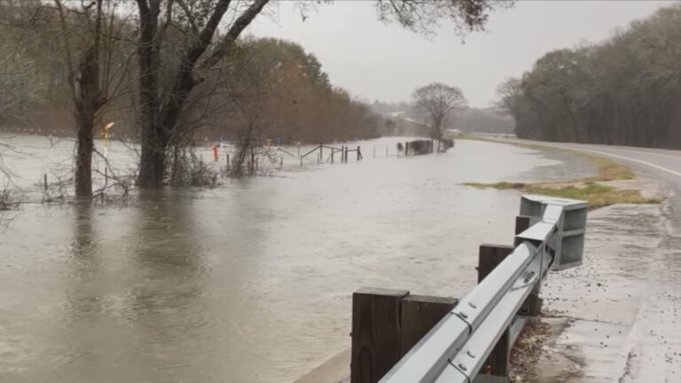
Should manage a healthy drink of water with this slow moving system. While we may not get rain everywhere every day, a widespread 1-2″ with localized totals of 3″ or more is not ruled out at the moment. After the front moves through Wednesday, stable and drier air will take over and we’ll see a much more tranquil finish to the week.
Widespread showers and a few thunderstorms are expected in the Brazos Valley as early as next Monday. A slow moving storm system will keep the rain/storm chance in play until a cold front pushes out all the moisture by Thursday.