First Alert Weather Day: Excessive Heat Warning through Tuesday night
BRYAN, Texas (KBTX) – Monday was our first triple digit reading for B/CS, and Tuesday will be our second, with even higher heat and heat index values expected.
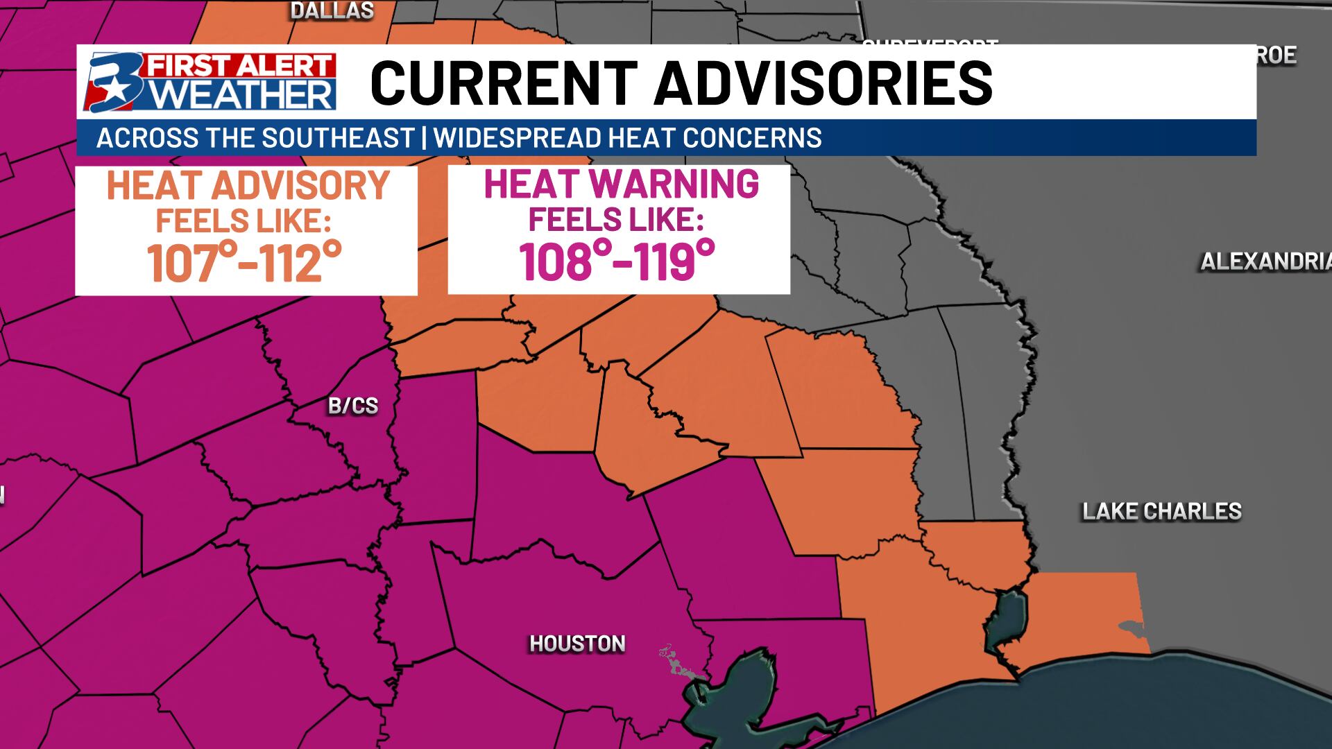
An Excessive Heat Warning is in effect from 10am to 10pm Tuesday for a majority of the Brazos Valley as we beat Monday’s “Hottest day of the year, so far” achievement.
An Excessive Heat Warning is meant to serve as a more significant alert than a Heat Advisory. The difference largely comes from not only the severity of the heat, but also the duration, and lack of cooling relief forecast for the overnight.
HeatRisk from @nws is beginning to ping at its highest value for both Tuesday and Wednesday for parts of the Brazos Valley and Southeast Texas.
The main concerns here: This is the hottest and hottest feeling we have seen in a mainly “mild” summer, with overnight lows above 80°. pic.twitter.com/TqsmDlx0HU
— Max Crawford 👍 (@KBTXMax) August 20, 2024
For those of us who will be indoors with working AC for most of the day for the rest of the week, this may not be an issue. The concern is for those who don’t have working AC or who will spend multiple hours at a time outdoors.
Take the heat seriously: Take additional steps to hydrate, keep cool, and set aside time for break AWAY from the heat if possible to allow your body time to cool.
Wednesday brings similar heat, so we may see this warning extended, but some noticeable relief should be coming before the week is done as high pressure moves to the north and east. It won’t be COOL by any means, but periods of extreme heat will be shorter lasting and we should manage some slightly cooler evenings.