Quick round of summer storms possible this evening
BRYAN, Texas (KBTX) – While most of us cook in the heat of the hottest afternoon of the year (so far) we will be monitoring the First Alert Radar for a couple storms by late afternoon and evening.
Keeping an eye on some showers and storms off to our north that our weakening as they head our way.
Not expecting much with THIS round, but if we get hot enough this afternoon, another disturbance may spark up some storms this evening. pic.twitter.com/ool9XT7Jsy
— Max Crawford 👍 (@KBTXMax) August 3, 2024
The ridge of high pressure that controlled the weather pattern last week has moved west, opening the door for a couple small upper level disturbances to potentially spark up a couple thunderstorms in the 5-9 o clock timeframe this evening.
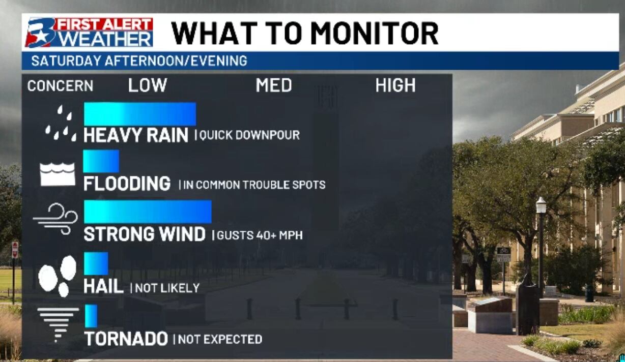
With temperatures expected to reach about 100° this afternoon, an “airmass clash” between cooler, denser, rain cooled air form thunderstorms and the afternoon heat may be enough to push out winds in excess of 35-40mph if we’re able to see storms pop up through the afternoon.
Isolated storms are possible Saturday evening. If any develop, they’ll need to be monitored for strong wind.
Overall, the severe threat is LOW. Most of us that see rain today will just find run of the mill summer thunderstorms, but we wanted you to be aware of this in case you have outdoor plans early this evening. At the very least, prepare for some cloud to ground lightning and brief, heavy rain.