Sunday morning storms produce hail, damaging winds across the area
BRYAN, Texas (KBTX) – Thunder, lightning, heavy rain, hail, and strong winds.
Storms across the Brazos Valley early Sunday morning had just about everything, including several tornado warnings, as a cold front pushed south into the Southeast Texas area.
8:25 a.m. pea-size hail falling in south College Station / Wellborn area @KBTXMax @KBTXShel @KBTXBerkeley @KBTXKayleigh @NWSHouston pic.twitter.com/GciBhHq0R5
— 🚨 Rusty Surette 🚨 (@KBTXRusty) February 11, 2024
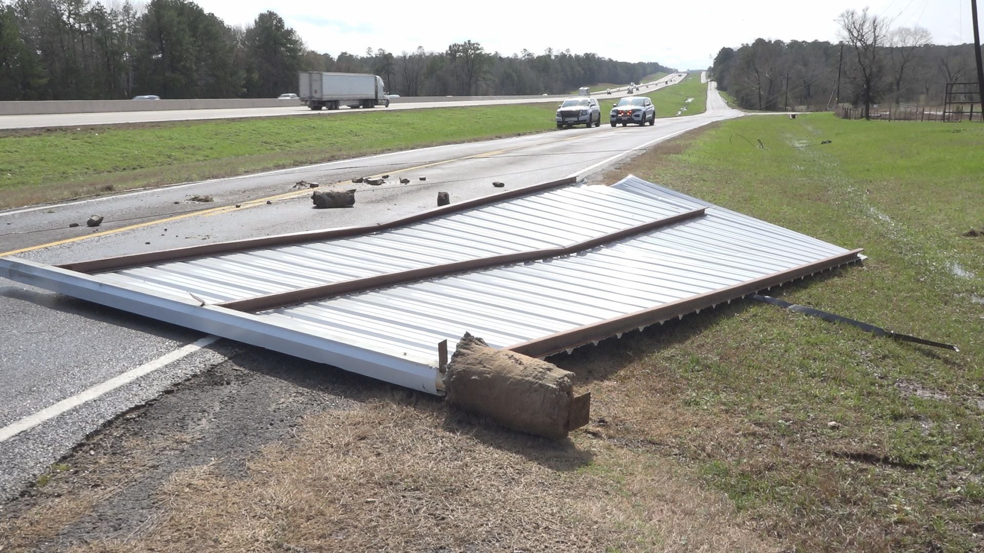
First responders and utility crews were dispatched to Interstate 45 near New Waverly in Walker County due to debris on the roadway from a destroyed shed and snapped tree limbs. Powerlines were also found on the ground in the area.
High water was also reported around Highway 30 at the San Jacinto River with additional reports of flooding in the Elkins Lake community in Huntsville.
Pea-to-dime-size hail was also reported Sunday morning in south College Station and Wellborn.
The same storm dropped marble-size hail in Grimes County.
RECAP: Here’s how our Sunday storms & severe weather played out across the Brazos valley this morning.
South Huntsville / I-45 damage currently listed as caused by wind. Several hail reports and multiple tornado warnings from two different storms as our cold front pushed south pic.twitter.com/1N1DrKPCXC
— Shel Winkley 👍 (@KBTXShel) February 11, 2024
No injuries were reported in Sunday’s storms.
Storms have cleared out and we look ahead to a return to more winter-like weather. Speaking of, inches of snow is falling up in the Panhandle as that same low-pressure system swirls across the state.