Weather Whiplash: Warm & windy, then two Arctic fronts crash into the area
BRYAN, Texas (KBTX) – Two arctic fronts are set to plunge the Brazos Valley back to winter. The bigger, colder front arrives before we wrap up the weekend, with hazardous cold expected to continue through Wednesday, January 17th.
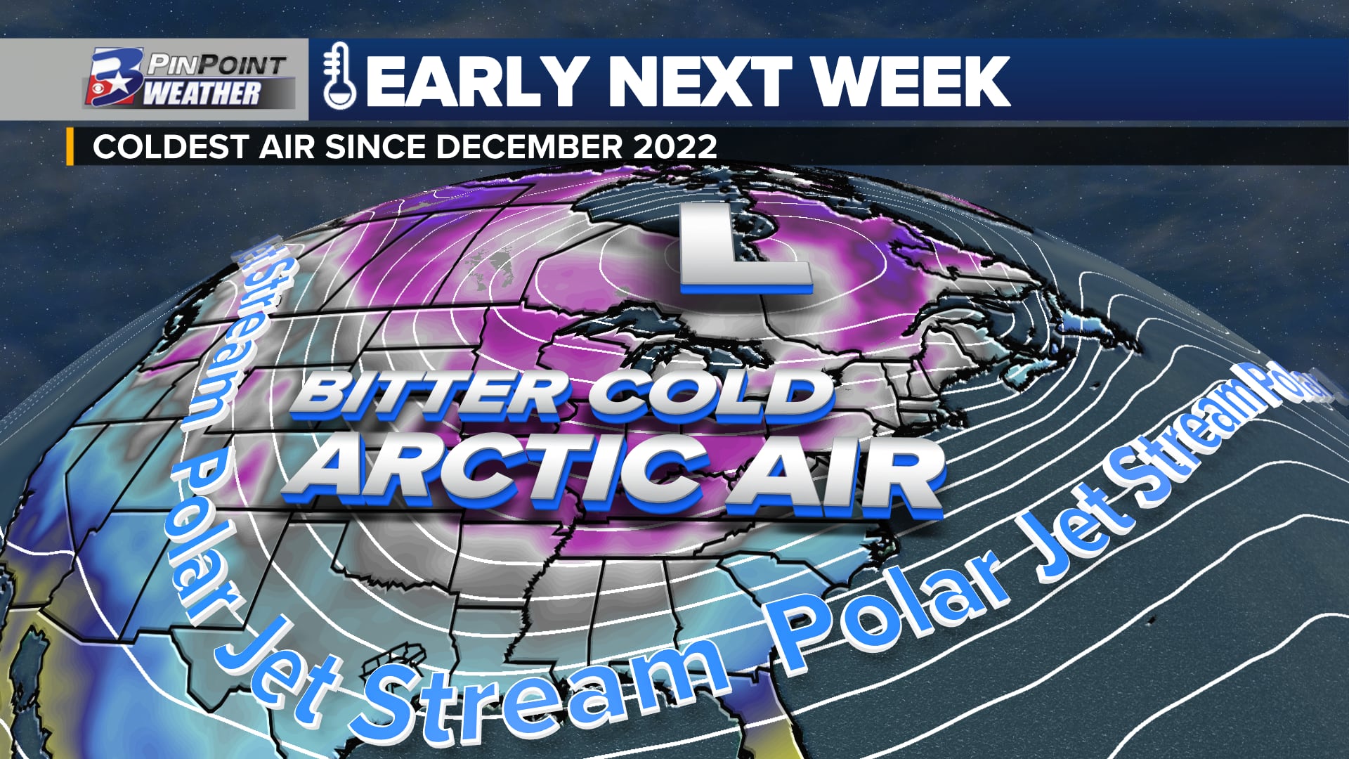
After a brief Thursday warm-up, MUCH colder air is set to arrive, especially by the end of this weekend. While a light accumulation of ice is possible as this system initially pushes through the area, the bigger story is the COLD which lasts into midweek.WHAT? Arctic air dropping low temperatures to the 10s and 20s and holding high temperatures to the 30s for a few daysWHEN? Sunday, January 14th – Wednesday, January 17thHOW COLD? Lowest temperatures are expected Tuesday, January 16th, potentially as low as 14° – 19°WHAT WILL IT FEEL LIKE? Wind chill values could fall as low as 0° – 5° sometime between Monday evening and Tuesday morningWINTRY PRECIPITATION? A mix of rain / sleet / or freezing rain would need to be monitored sometime between Sunday night and Monday. Light accumulations may cause minor travel issues through Monday afternoon.WHAT CAN I DO BEFORE THE FREEZE? Winterize your home and property. Remember the 4 P’s: People, Pets, Plants, Pipes.WHAT IS THIS NOT? This is NOT the same as the February 2021 freeze that highly impacted Texas. The duration will be much shorter, temperatures will not remain below freezing for more than a couple days, and ice/snow is not expected to entomb the state.
After a brief Thursday warm-up, MUCH colder air is set to arrive, especially by the end of this weekend. While a light accumulation of ice is possible as this system initially pushes through the area, the bigger story is the COLD which lasts into midweek.
WHAT IS A HARD FREEZE?
The coldest temperature experienced at this observation site so far this season: 31° on December 11th. While cold enough to end the growing season for some exposed plants, it has not been cold enough to damage property or pipes.
Hard Freeze warnings are expected for the Brazos Valley by early next week
The National Weather Service defines a HARD FREEZE as temperatures that equal or fall lower than 24° for two or more hours. This type of freeze can cause pipes to freeze if left uninsulated or protected. As water expands inside the pipe, fractures or cracks can occur that will eventually become exposed once temperatures warm enough for the pipes to thaw. A hard freeze can also damage or kill hardy plants that do not have an extensive root structure to keep them healthy through extreme temperatures.
WINTRY MIX SUNDAY/MONDAY?
One of the more “fluid” elements to the forecast includes a wintry precipitation possibility as this system rolls in Sunday afternoon/evening through about midday Monday. While moisture will not be hugely available, some gulf moisture may “overrun” the deep, cold air as it arrives at the end of this weekend and a little into MLK Jr. Day. While we wait for the deeper, colder air to arrive, that will create a brief window for some drizzle to light rain, or even some sleet.
After a brief Thursday warm-up, MUCH colder air is set to arrive, especially by the end of this weekend. While a light accumulation of ice is possible as this system initially pushes through the area, the bigger story is the COLD which lasts into midweek.
Overall, this is not a major concern at the moment. Minor accumulations could lead to some travel headaches Sunday night through the first half of MLK Monday before wind and colder/drier air sublimates any ice that may have accumulated. This is not expected to cause any power outage issues due to accumulation on trees/powerlines.
WHAT CAN YOU DO TO PREPARE NOW?
Temperatures are expected in the 60s and 70s Wednesday and Thursday afternoon this week. While weekend temperatures will be colder — 40s and 50s — there is still several days to prepare for the bitter cold air that is expected to reach the Brazos Valley early next week.
Plants: Bring potted plants inside a shelter like a shed or garage. Apply a thick layer of mulch around the base of hardy plants to insulate the ground. This weekend, Watering plans will help trap heat or slow the heat loss around the plant. A sheet or box/container can also be used to cover plants. Be sure to uncover the plants again after the threat of a deep freeze has ended.Pets: Bring pets indoors. Ensure adequate warmth and water for livestockPipes: Cover or insulate exposed pipes, including those underneath raised homes. Open cabinet doors to allow warm air to reach pipes under indoor sinks located on the outer walls of homes.
HOW DOES THIS COMPARE TO THE CHRISTMAS 2022 FREEZE?
Here is a side-by-side view of the temperatures experienced in December 2022 versus the forecast temperatures for the upcoming Arctic blast (as of Tuesday, January 9th):
HOW DOES THIS COMPARE TO THE FEBRUARY 2021 FREEZE?
IS THIS A HISTORIC COLD?
There is a chance that some of the expected temperatures ahead either tie or come close to records for the coldest ever experienced at Mid-January in Bryan-College Station’s 141 years of record keeping. Those records currently stand as such:
Bryan-College Station has not experienced any sort of record cold — low temperature or coldest high temperature of record — since the February 2021 freeze event.
Checking in on the @ERCOT_ISO supply/demand forecast as of Thursday morning. Supply still currently forecast to remain above demand for next week.
Biggest day to watch will be this coming Tue AM as temperatures plummet. The good news is we should see a lot of sunshine Tue PM pic.twitter.com/2KfwLf0e6p
— Max Crawford 👍 (@KBTXMax) January 11, 2024
Simply put, there is A LOT to keep track of, with new weather to experience each day from now through at least the middle of next week. This is a forecast that will continue to be adjusted as forecast data understands and handles this shallow, polar airmass better in the coming days. Details will be updated here at KBTX.com, on-air, on social media, along with the KBTX PinPoint Weather App.