Gulf of Mexico system strengthening, poised for Texas landfall
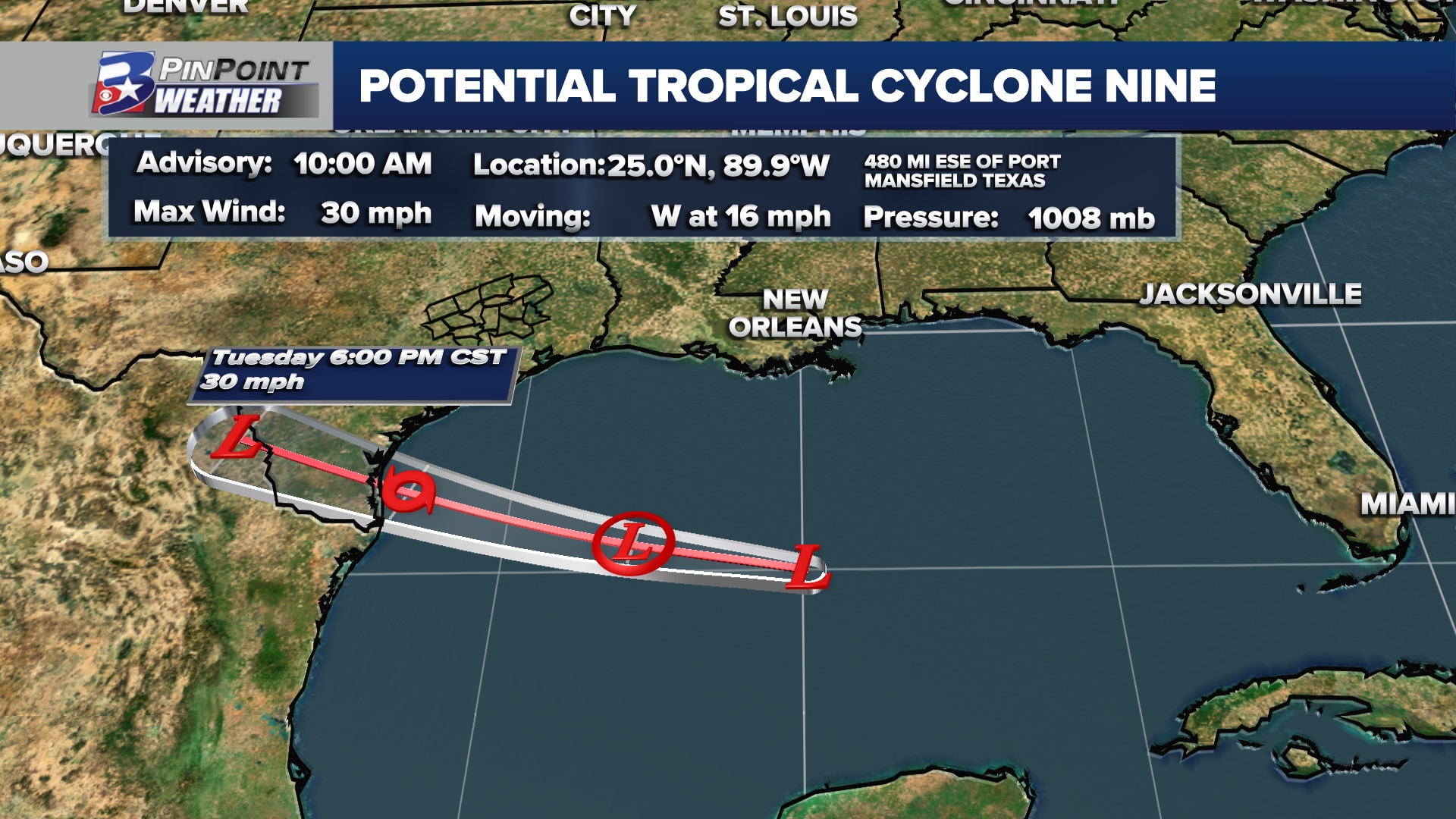
BRYAN, Texas (KBTX) – Forecasters with the National Hurricane Center have designated the disturbance in the Gulf of Mexico as Potential Tropical Cyclone Nine, or what could become Tropical Storm Harold ahead of landfall in South Texas.
Tropical Storm Warnings have been issued along the coastal Bend stretching from Corpus Christi to Brownsville.
While wind and storm surge will be a factor, especially if Nine strengthens to Harold, this will primarily be a rainmaker for South Texas. For the most part, this will be beneficial rain, as most of South Texas is in drought.
Potential Tropical Cyclone #Nine Advisory 1: Tropical Storm Warning Issued For Portions of South Texas. Flooding Rains and Coastal Flooding Are Possible. https://t.co/tW4KeGdBFb
— National Hurricane Center (@NHC_Atlantic) August 21, 2023
BRAZOS VALLEY IMPACTS
The best overall chance for a glancing blow from an outer rain band or two will come Tuesday morning through late afternoon. While the most widespread, heavy rain looks to fall south of I-10, a tropical downpour could be responsible for a tenth to quarter inch or more from Tuesday through Wednesday. We will stay breezy both Monday and Tuesday as the system moves closer and eventually into Texas.